HEC-HMS Rainfall-Runoff Simulation
Example of Gridded Rainfall-Runoff Model of:
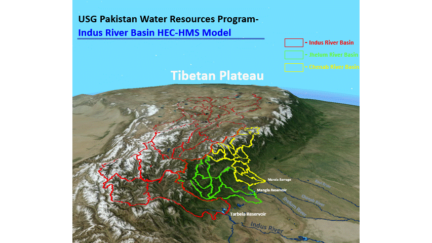
Upper Indus Basin
Jhelum Basin
Chenab Basin
Overlaying Gridded Precipitation Over Basins
HEC-RAS Indus River Modelling
Example of HEC-RAS flowlines resulting from upstream dam failure.
Upper Indus Gridded HEC-HMS Model Visualization
3d Flyover of Upper Indus Basin and Indus River Basin showing Gridded HEC-HMS Model visualizing Basin from upstream to downstream through Indus River Valley.

Upper Indus Basin Snowmelt Model - NASA ROSES Grant
o Awarded 2018 NASA Research Opportunities in Space and Earth Science ROSES Grant to assess mountain snowmelt runoff from the Upper Indus River Basin in the Himalayan Mountains and resulting impacts to water management in the Indus Basin Irrigation System (IBIS).
Indus Basin Irrigation System HEC-ResSim Model
Developed Indus Basin Irrigation System (IBIS) HEC-ResSim Model which simulates the operations of Tarbela and Mangla Reservoirs to meet downstream irrigation
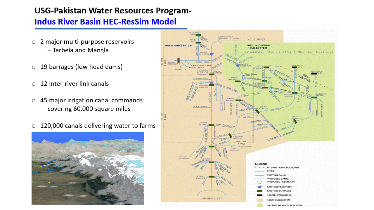
HEC-ResSim Model used to forecast Tarbela Reservoir's flood control and irrigation operations and resulting reservoir pool levels.

3d Visualization of HEC-RAS Flood Inundation of Indus River
Flood inundation downstream of Tarbela Reservoir on Indus River. 3-dimensional visualization of inundation shows Tarbela Reservoir releases in 3-dimensional format.
2D Unsteady HEC-RAS Modelling
Showing HEC-RAS 2D results of upstream dam failure causing overtopping breach failure of a downstream levee system
3d Visualization of HEC-HMS Precipitation over South Asia
Spatial and Temporal distribution of daily precipitation of August 2018 monsoon over South Asia applied to HEC-HMS Model.